I was tipped off by Modern Hiker that the new version of Google Earth (5.2) is out and now it provides the elevation from its digital elevation model (DEM). Now when you create a path, you can right click on it's name in the sidebar and go to "Show Elevation Profile." Something like below should open up:
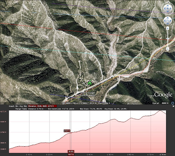
If you try to save the .kml file, the elevation data won't be included, so use of the elevation is inclusive only to viewing in Google Earth. Still, this addition combined with the topo overlay offers excellent options for route planning.
This is sweet. I've been playing with the latest version of Google Earth, and it's great to know that it pulls the elevation profile from the actual topological data vs. the (often inaccurate) GPS data from my low-end eTrex Venture.
ReplyDeleteThanks for confirming!
yes and I think combined with the topo overlay abilities this makes Google Earth a powerful mapping tool. For exploratory hiking, it's my primary software.
ReplyDeleteHe Ze, good find, thnx for the Post. Bob L
ReplyDelete