Showing posts with label google earth. Show all posts

Tuesday, June 22, 2010

Google Earth Mapping Discussion Update

Earlier this year I outlined a way to overlay topographic maps in Google Earth, and subsequently get out path information to make maps and upload to your GPS device. The main downside with this method was that Google Earth did not provide elevation data when you created a path, so you would also have to use something like GPS Visualizer to get that information.

I was tipped off by Modern Hiker that the new version of Google Earth (5.2) is out and now it provides the elevation from its digital elevation model (DEM). Now when you create a path, you can right click on it's name in the sidebar and go to "Show Elevation Profile." Something like below should open up:
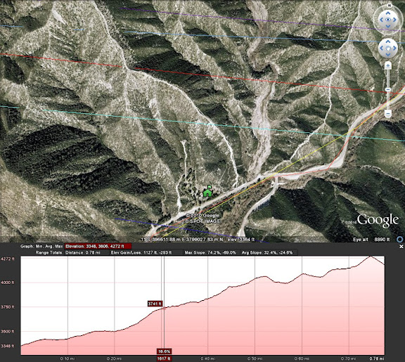


If you try to save the .kml file, the elevation data won't be included, so use of the elevation is inclusive only to viewing in Google Earth. Still, this addition combined with the topo overlay offers excellent options for route planning.

Thursday, February 11, 2010

Google Earth Topo Overlay - A Mapping Discussion

One of the 10 essentials is a map (and a GPS is nice too), especially if you are going into a new area, or even better (worse) going off maintained trails to do some fun exploration.


When this happens, often times available maps (i.e. USGS topo, Tom Harrison maps) are not sufficient because the trail / area you planning on using isn't there.

So some people like to use mapping software like National Geographic TOPO! or Garmin Mapsource to make maps and wapoints to print out and download to a GPS.

Well now I think there's a better, if not somewhat more tedious option.